Trip Report
Journey to the Lower Pecos Canyonlands
Expedition to view and photograph the Rock Art of Indigenous people
January 28-30, 2025
The idea:
After reading Pam LeBlanc’s article in AAA Explorer Magazine, January 2024 issue, I decided that continuing with my quest to learn more about Indigenous peoples of the Southwest and their culture and history, viewing the rock art in a remote part of south Texas (Val Verde County, Comstock, TX
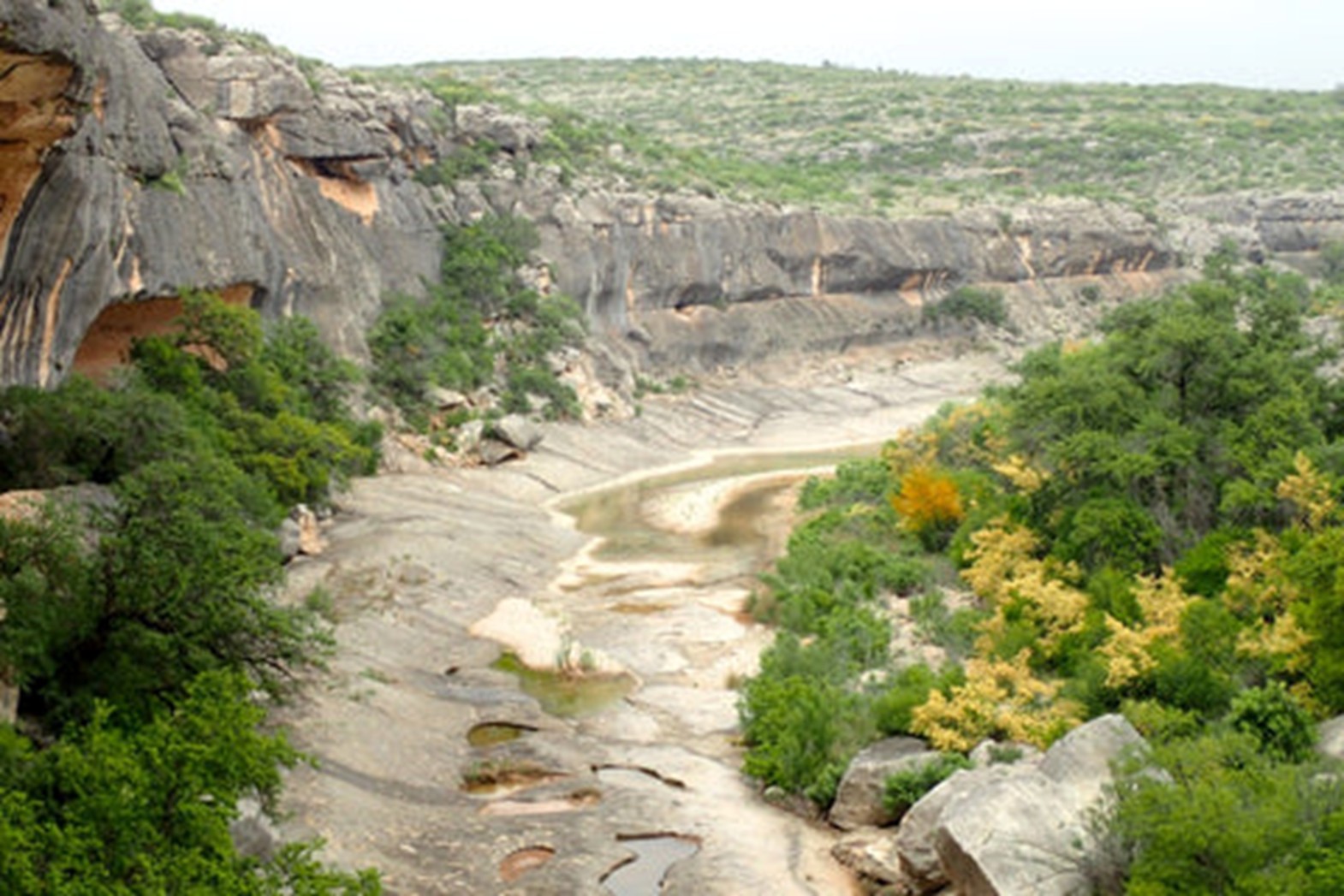
Coordinates: 29°41′4″N 101°10′24″W) would enhance my understanding of those peoples that inhabited the area. Comstock is the town nearest to Seminole Canyon State Park, which has been a site of human habitation for 9,000 years. Explorations would take us deep into Seminole Canyon.

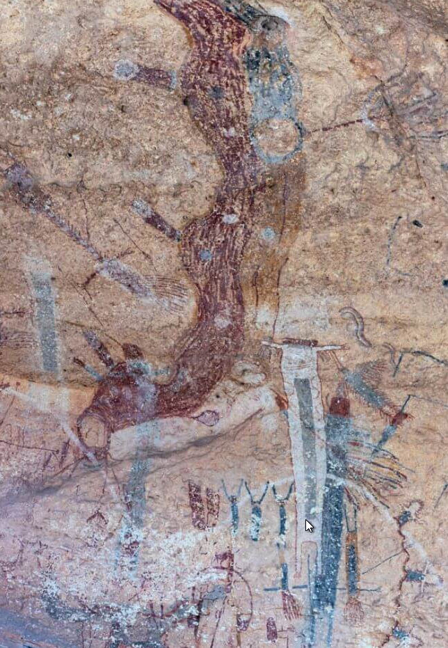
The expedition would be guided and led by representatives of Texas Parks and Wildlife. Seminole Canyon State Park and Historic Site has cave drawings and other evidence of settlement dating from the early Archaic period, around 7000 BC. Later remains include stone circles and cairns of the late Prehistoric, and even 19th-century remains from the construction of the Southern Pacific, one of the nation’s first transcontinental railroads. Shumla, a scientific study group, on their website talks of their mission and purpose: “Each mural in the Lower Pecos Canyonlands was authored and composed to communicate thoughts and ideas. These ancient paintings are visual narratives that will rewrite the prehistory of North America”. At Shumla, they work to preserve and share the “library” of painted texts and the information they hold through documentation, research, stewardship, and education.”

Shumla, which would have been our first choice of leading the expedition. Because of the timing of our expedition, Shumla could not accommodate us so we will be touring with TX Parks and Wildlife. This exploration would also serve as background information and a scouting trip for a possible future quarterly meeting of The Explorer’s Club.
Even though Shumla could not accommodate us in our timeframe, they did respond and provided us with some valuable information which I’ve included in the Resources section below.
Overview Plan:
Monday. 1/27: We will have tested our gear. We will have made a few adjustments to cover a wide-range of possibilities allowing for bad weather and changes of plans. I was very pleased with my packing decisions: A super large North Face Base Camo XL 132 L duffle for gear, a 71L North Face Base Camp duffle for clothing, and a Camelback mid-size day backpack for trekking. If all goes according to plan, and my stamina holds up, and my sleeping is adequate (no BiPAP on this trip), the itinerary will look something like this:
Tuesday, 1/28: Leave Cedar Park around 7:30 AM. Arrive at the site around 2-3 PM. Set up camp and cook evening meal. Plan for the next day.
Wednesday, 1/29: Morning activity consists of us hiking into and out of the Canyon, touring Fate Bell and Fate Bell Annex with a Park Ranger, and photographing Rock Art. In the afternoon, hike to the overlook of Panther Cave or the overlook of Presas Canyon.
Thursday, 1/30: We could go on a hike or break camp. Then we either attempt a tour of Shumla’s facilities, or we head towards Langtry to our two alternative sites (White Shamen and Eagles Nest). Return to Cedar Park.
The Team:
- Bob Rein – Member National MN’24, The Explorers Club, Role: Ethnographer, North America Indigenous People.
- Tom McGuire – Member National MN’22, The Explorers Club, Role: Expedition Documentation / Photogrammetry expert.
- Park Ranger – Seminole Canyon, Role: Guide and historical tour leader. The park requires this role.
Location:
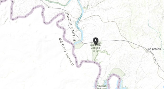
The Park HQ is located at: Latitude: 29.700094, Longitude: -101.312875. It is bordered by the Devil’s River to the east, The Pecos River to the west, and the Rio Grande River to the south.
Detailed Plan:
- A Seminole Canyon Park Ranger would lead us on the exploration of Fate Bell Annex, Fate Bell Shelter. We meet with the Ranger at 10 AM. The exploration and tour would take about 1.5 to 2 hours. We will be taking pictures for use in developing a 3D Model using photogrammetry techniques.
- Difficulty: Moderately strenuous, hiking distance: 1.5 miles, Approximate Elevation Gain 375 feet
- Description:
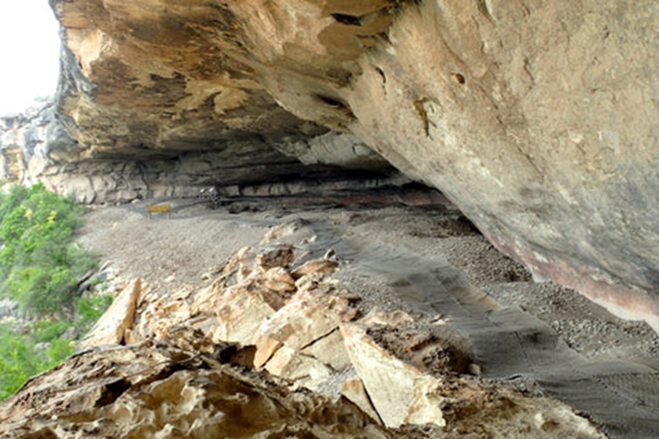
Fate Bell Annex & Fate Bell Shelter are situated in Seminole Canyon State Park and Historic Site. Seminole Canyon is a major tributary of the Rio Grande River. Fate Bell is one of the most famous and largest Pecos River style rock art sites in the Lower Pecos Canyonlands Archeological District — A National Historic Landmark. Not only is the rock art breath-taking, but the archaeological deposits within the shelter are also extremely well-preserved. I will be hearing about the incredible rock art, the lifeways of the people who painted it. - Weather Forecast Prior to Departure:

- Training & Gear Selection:
- To be physically fit for this expedition, going on a few hikes with high elevation changes should suffice. Normal exercising is also recommended.
- Normal Tent camping kit for this trip. Amenities at the campsite include BBQ pits, picnic table, lantern pole. This is a primitive site so there are no utilities or restrooms and showers. We are camping at Roadrunner Flat campground loop, site 040.
- Since temperatures will be in the low 50’s at night, colder weather sleeping gear will be needed.
- Potentially, I may active my Garmin inReach device, but we are taking Baofeng Radio’s with emergency communications and NOAA weather.
- A backpack with small first aid kit, binoculars, and a hydration bladder will be needed as well as trekking poles as it is a steep descent into and out of the canyon.
Budget:
The entire trip, which would include fees, permits, touring, meals, and gas was estimated to be around $130-$150 per person.
Execution:
We departed Cedar Park at 8 AM and after a 4.5-5-hour drive, we arrived at Seminole Canyon State Park. This park is located off I-90 about 10 miles west of Comstock, TX. It is part of the Lower Pecos Canyonlands and borders to the east by the Amistad National Preserve and the Devil’s River. To the west is the Pecos River and it borders on the Rio Grande River to the south with Mexico across the river. The team consisted of fellow Explorers Club member, Tom McGuire. Tom was to take the lead in the image captures of the Rock Art for 3D modeling with photogrammetry. My role was to understand and relate the linkage (linguistic and cultural) between the Indigenous peoples of the era (about 4,000-6,000 years old) and tribes of the area that succeeded them.
Camping was rough for me that day. Several things went wrong. Some could have been avoided, others couldn’t.
- I had brought 2 sets of tent poles, one from the tent I was using and one from an old tent of a different size. I brought it as a backup. Inadvertently, I picked the wrong set of poles and could not get the tent up, trying for a half hour to figure out what I was doing wrong. In wondering why, I never had this problem before, Tom interjected and suggested I might be using the wrong poles. After realizing my rookie mistake, the tent went up in a matter of minutes.
- As I slept, I got a wave of claustrophobia, a condition I developed during my military career, and so I left the vestibule rain fly, tied up (there was no rain at the time). As I slept, rain started, and it came into the tent through the mesh. The winds were gusting to near 20 mph and it blew open the vestibule rain fly portion. I awoke, zipped the fly and went back to sleep or tried to. I got claustrophobic from the encasement and spent the rest of the night awake or dozing off sitting in Tom’s car. I did not have the luxury of having my sleep apnea machine with me as we were primitively camping with no electricity or water at the site.
- Temperatures were in the low 50’s but with the wind chill, temps felt like low 40’s. These factors took a toll on me and in the morning, my energy level was minimal. Thus, I opted to not hike down the canyon and waited for Tom to return.
Tom was able to view and do limited photography based on the distance restrictions the park and tour guide had and enforced. Both the ascent and decent were especially challenging and difficult due to the steepness of the hike.
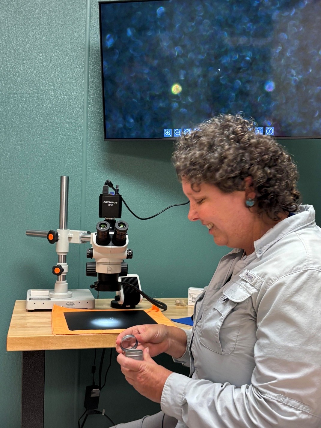
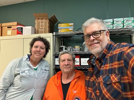
When we first planned the exploration, we set our sights on asking Shumla, the research non-profit scientific study group, for a tour of their facilities to see and learn their data capture techniques and their archiving methods as they are totally focused on the exploration of Indigenous Rock Art of the Lower Pecos Canyonlands area. They declined our request as they were committed in the time frame we needed to meet. They did, however, send us very useful low-resolution models they built. See below. Bad weather was rolling in (even worse than the day before) so based on our physical condition, we opted to leave a day earlier than planned. On the way back, we decided to have lunch in Comstock and just drop by Shumla to see if somehow they would accommodate us. Luck would have us, their plans for the day also got cancelled due to the weather and they graciously allowed us to visit with them.
Dr. Karen Steelman, a chemist and 8-year veteran of Shumla, spent almost 2 hours with us. She gave us the tour of the facilities, demonstrated or explained the various technologies used, answered about a million questions Tom and I posed.
We both came away incredibly impressed by the work Shumla does and how they go about preserving the history and majesty of the Indigenous people of the areas.
We then drove the 4.5-5-hour trek home, driving through fog, rain, wind and just miserable conditions. Parts of the trip were disappointing (me not seeing the Rock Art) but there were parts that were incredibly wonderful. I have long dreamed of seeing Seminole Canyon and I added to my ethnological knowledge of the tribes of the American Southwest. Tom and I are considering other explorations in the area, one being an attempt to capture the experience of Panther Cave. Panther Cave is a similar site with Rock Art paintings. Panther Cave is accessible only by boat and permission is needed to visit the site. It lies on the Rio Grande within the Amistad National Preserve.
Debrief:
Reflecting on the expedition, there were both things we did right and things we could have improved upon and became learning points.
What went right:
- Tom was able to view and photograph the Rock Art.
- We were able to meet with and tour Shumla and view and understand their techniques and technology for the capture, analysis, and archiving of these historic paintings.
- I was able to understand the key linkages (linguistic and culture) between the Indigenous people from the early Archaic period, around 7000 BC to those of the tribes I have previously studied that succeeded them.


What could have gone better:
- Certainly, I could have been better organized and not taken the old tent equipment.
- The weather did not cooperate. We did have the proper rain gear. The weather limited us to what we could have seen but the footing would have been unsafe.
Resources:
As stated above, Shumla did provide us with some of their low-resolution models:
Structure from Motion Photogrammetry:
To view photogrammetry 3D Models, click on the image and move your mouse around.
Giga pans:
Giga Pans, as defined in Wikipedia, are “gigapixel panoramas, digital images with billions of pixels. They are huge panoramas with fascinating detail, all captured in the context of a single brilliant photo. Phenomenally large, yet remarkably crisp and vivid, giga pans are available to be explored at https://www.gigapan.com.”
If we had more time to explore, we would have liked to explore other sites. Since the Lower Pecos Canyonlands span an area of several hundred miles, one could make this a dedicated area of exploration if interested in prehistoric indigenous history and culture. For more information on the Lower Pecos Canyonlands, please check out this link: https://www.texasbeyondhistory.net/pecos/
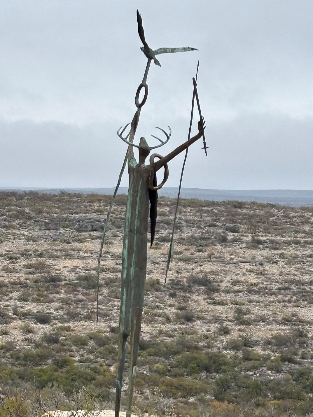
- An example of another close-by area worth exploring lies just to the west of Seminole Canyon. Highway 90 route when coming in from the East or even Central or North Texas yields many things to see along the way. Close to Langtry there is another great place to see. The road crosses a very short bridge. There is a little sign that says Eagles Nest (new name) and it is very easy to miss. The old name was Mile Canyon, and it is the prehistoric site of the Bonfire Shelter where the native people ran Buffalo off the cliffs. The canyon rims on both sides are private property. The view is looking West. The Mountains are in Mexico.
- There is another must-see rock art location called the White Shaman Mural. This mural is located as you cross the Pecos River bridge heading west towards Langtry on Hwy. 90. The cave in which it sits houses the mural which is 65’ across, 23’ high, and 26’ deep. The discovery and archeological efforts are documented in a book, “The White Shaman Mural” by Carolyn Boyd of Shumla. I purchased this book, and it is extremely detailed and written more so for an archeologist.